CityDashBoard TalesofThings MapTube
Qrator Tutorials About Digital Urban
MRes ASAV SurveyMapper Contact Us
Showing posts with label London Underground. Show all posts

2009-10-05

Tube Map on Vimeo - Updated

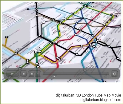
This is a quick post - just to mention that our animation of the London Underground is now on Vimeo. Next step, if we get time, is to animate it according to the year of construction:

Second Movie of the 'Growing' London Underground Network from digitalurban on Vimeo.


Music is by the Creeping Charlies.

The map is kindly mentioned in the Guardian Article by Charles Arthur 'Government site puts data visualisation on the map'. The gallery linked in from the article is really interesting and well worth a look.

The previous movie with landmarks is below:

London Tube Map Geography:Visualisation Draft from digitalurban on Vimeo.


As a side note, us here at digital urban and the nice people at CASA are about to start drafting a MSc course on all things spatial and digitally urban, we will be asking for thoughts on content so watch out for a forthcoming post...

2008-03-18

London 3D Tube Map in Google Maps


Sometimes when jumping from project to project and tutorial to tutorial projects get lost and posts overlooked.

One such example is our 3D Tube Map which, despite being something we are quite proud off, sat on the shelf for a while due to lack of time. Embedded below is the project so far - click and drag to pan around and zoom in and out using the usual google map interface (created using our free Image Cutter Software):


UCL is currently working on a render farm of 250 or so processors for our London model, so fingers crossed the 3D Tube project will be back in movie form soon.

For those with eagle eyes we know of at least two 'errors' in the map :) We will get these fixed and if anyone wants the image as wallpaper let us know your resolution and we'll post up an image.

View the map full screen

Update -Digital Geography - Geographic Visualisation for Urban Environments, the booklet of the blog is now available to buy.

2007-08-07

Iconic London Image - Geographic London Underground and 3D Buildings Update


Another update on progress with regards our 3D London Underground map.

The main map is complete providing a top down view of the actual geographic location of the London Underground Network. At the moment we are working on ways to give it a alpha channel and overlay on Google Maps, a Google Earth version is also in the pipeline.

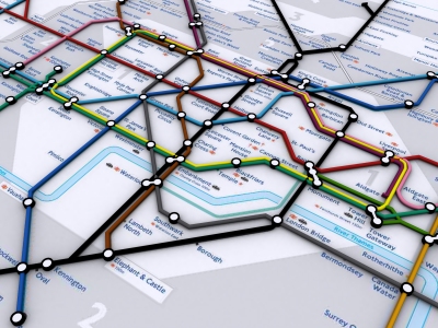
If you give the map a slight tilt and add various 3D buildings of London then the map takes on a more iconic view of London:


The final part of the update was adding in all the underground stations names as 3D text allowing for a higher resolution render:


Embedded below is the iconic view of London rendered at 10000x5000 pixels and displayed via Google Maps using our Google Image Cutter Software:

Double click to zoom in or use the slider bar and drag to pan:


You can also view this full screen (recommended).

If people would be interested as using this as wallpaper then let us know and we'll render out various resolutions..

2007-07-30

Iconic London - 3D Tube Map Update


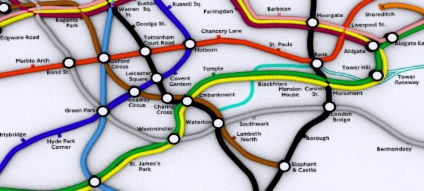
A quick update on our Iconic London 3D Tube Map - we are going through the process of vectorising the base data which basically involves re-entering all the tube station names in 3D Max. Its turning into a slight labour of love which seemed like a good idea when we first thought about it, the image below details progress so far in the central section.

Click and drag to pan or the +/- icons to zoom in and out:


The final London wide version should be ready shortly...

2007-07-20

Iconic Cities - London Thoughts

Since the arrival of Google Earth a lot of our work has been focused on the geographic and photorealistic representation of the city. With a Geographical Information System (GIS) you can easily overlay data and communicate issues to the public at large.

An example of this is our air pollution movie below -


While such views of the city undoubtedly communicate space and place a constant emphasis on aerial photographs can become slightly dry. As such our look at the 3D London Underground map has led to a new look at iconic images to communicate locational and spatial data:


The image above represents our first thoughts (click for a larger view) - its a Friday thing...

2007-07-19

3D London Underground Image


Readers maybe aware of our on-going work to build a 3D map of the London Tube network. Depth information is hard to come by due to issues of security therefore the work has concentrated on creating a 3D geographic location map.

Aimed at creating a 'plasticine' look to the routes the interactive image below illustrates a work in progress produced so we can easily identify the errors. Double click to zoom in and drag to pan:


The final cleaned up version will be online shortly.

You can also view the image full screen (recommended).

Thanks go to Simon Clarke who produced the original geographic tube map. Simon's site is currently under reconstruction in the meantime take a look at other London Underground diagrams.

2007-07-18

Tutorial - The 3D London Tube Map from Adobe Acrobat to 3DMax


Rapid visualisation of networks can be carried out by simply converting Adobe Acrobat documents to .dwg format as we detail below with a quick render of the London Tube map:

Modelling of the tube lines was possible using the following workflow:

1) Download a Acrobat formatted 2D map from the London Transport site;

2) Import into Adobe Illustrator;

3) Export as .DWG which preserves the vector line data;

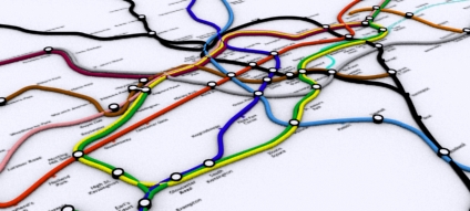
4) Import into 3DMax and converting the line data into 3D Splines.

This provides a quick and easy way to transform a 2D map into 3D. A movie illustrating work in progress is embedded below:


The same technique can be used for the actual geographical location of the London Tube Network:


These are sample images of a file recently retrieved from a lost disk - we will be updating the 3D Map over the coming weeks.

2006-07-05

3D London Tube Map


A while ago we built a map of the London Tube network.. its neat but to be honest not all that much use (?). Somewhere on our hardrive is a real location of the map in 3D as well, we will hopefully dig that back out in a few days. You can view the current 'classic' London Tube Map below:


The reason for the post? We were going to add in depth data to produce a real representation of the tube network. Sadly due to security fears (which are understandable to say the least) this looks like it wont happen. Still, it would of made a neat flythough...

A higher res version can be found can be viewed from here (23Mb). Note the movie uses the DIVX codec.

2005-12-21

3D London Tube Map Update


A quick update on the real 3D tube map of London. Data on the depth of the tube stations is proving tricky to get hold of due to security issues. One simple way would be to count the number of steps down to each station - so if anyone on their way to work could count the steps down and email them in that would be great!


The map can then be updated as and when the number of steps are sent in..

2005-11-10

3D London Tube - Streaming a Movie via Flash


The majority of our movies have been encoded in Divx which although useful for compression does mean that people need the correct codec installed. As a test we have put online a movie encoded into Flash so the majority of users will be able to view it. The filesize is also compact, down from 23Mb to 2.2Mb which should be streamed from our server.

The movie itself features a fly through of the iconic tube map of London.

Any comments would be welcome...

View the movie encoded in Flash. (2.2mb).