CityDashBoard TalesofThings MapTube
Qrator Tutorials About Digital Urban
MRes ASAV SurveyMapper Contact Us

2006-04-26

Ipod Culture - Perception of Urban Space Now with YouTube Movies


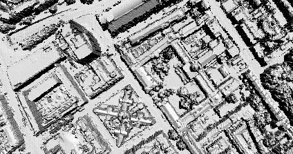
Our perception of urban space is based on sight, smell, sound and to some extent touch. Portable music became main stream in 1979 with the introduction of the Sony Walkman and with it came a change to the way we perceive the space around us. By filtering out the natural and man made sounds of the city we are able to immerses ourselves in a alternative reality of our choosing.

The rise of the Ipod has placed this change of perception at our fingertips - to illustrate this we placed a webcam in our button hole, linked it to a laptop in our bag and record the sound from the ipod playing on our way to work.

The resulting movie is an insight into how the choice of music changes our view of the urban environment. In our case it is almost immersing yourself in a real-time MTV world as we consume the urban environment accompanied by the beats of a dance track. Our walking pace moves in time with the music and the environment becomes a backdrop to the video of space.

Perception changes according to the music chosen... take a look at the video and let us know any thoughts. Note the quality is mixed due to the mounting of a webcam in a jacket button hole but as a first test it gets the point across...


*****


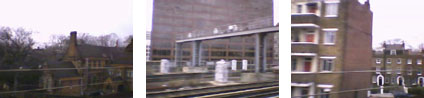
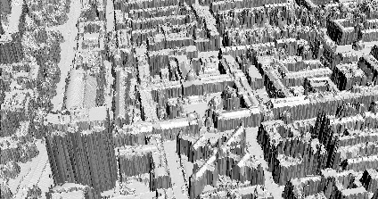
Continuing the series we have a new movie exploring the perception of urban space and audio - this time from a train approaching the city. The music on shuffle mode is in stark contrast to the previous movie and thus creates a different perceptual view of the city.


We are still not sure where we are going with these but any thoughts are welcome...

2006-04-25

Westminster Abbey, London Night Time Panorama


Westminster Abbey is a work of outstanding architecture, constructed between the 13th and 16th centuries. The Abbey has been the location for numours Royal Weddings as well as every Coronation since 1066. The building as it is today features the west towers which were completed to the designs of Sir Christopher Wren and Nicholas Hawksmoor.

Recently filming of the Da Vinci Code was refused by the Church at Westminster, Lincon Catherdral takes its place in the forthcoming film.

View the panorama of Westminster Abbey, London (2.2mb).

London Eye, London Night Time Panorama


The London Eye was designed by Architects David Marks, Julia Barfield, Malcolm Cook, Mark Sparrowhawk, Steven Chilton, and Nic Bailey. Standing at 135 metres high the wheel travels at 0.6mph and takes 30 minutes to complete a revolution.

The Eye has acted as a focus point for the regeneration of the South Bank area of London which is now home to a unique collection of restaurants, art galleries and shops.

View the Quicktime panorama of the London Eye at night (1.4Mb).

Oxford Circus, London Night Time Panorama


Oxford Circus's location at the junction of Regents Street and Oxford Street makes it a central location for shopping in London. It is within a short walk of the main shops on Oxford Street or the side lanes leading west to Bond Steet or east to Carnaby Street.

In short its a central point for London shopping.

View the Quicktime panorama of Oxford Circus at night (3Mb).

2006-04-20

Panorama Movie - Update YouTube

Rendering a panorama in polar co-ordinates a movie can be created to fly into a scene from above and then change the camera field of view to display the scene 'as is'. It provides a unique view of the urban scene - but is it useful as a visualisation? Well, that's debatable but it makes a neat movie...

The movie is embedded below via YouTube

Urban Video via YouTube

This is a sample post to display movies in a blog via YouTube. Rather than add direct links to the movies already on the blog it is now possible to upload them into YouTube and embed them direct. This should get rid of the codec issues and allow them to be easily viewed...


The video above is the sample Lidar movie of London using raw laser point data. If this is an acceptable format we will upload the other movies in the blog...

We should also be able to get YouTube into Google Maps and down the line Google Earth, as soon as we get it running we will post a few samples and code.

Thoughts or comments would be great...

2006-04-19

Coming Soon...

We are taking a slightly extended Easter Break but coming up over the next seven days are a series of new London Night Panoramas including the London Eye, new Lidar Movies and news on the forthcoming London model as well as a review of VTour by RealViz along with some sample movies.

Also on the horizon are a series of historic maps in Google Earth thanks to a new link up with the Birbeck Slide Library and finally those Fantasy Architecture models in Google Earth which are continuing to be tricky to convert...

Any thoughts or comments as always welcome as well as requests for content...

Smithee

2006-04-06

Michigan Avenue Chicago Panorama


Located in Central Chicago the Wrigley Building was designed by Charles G. Beersman in 1919. Situated on the corner of North Michigan Avenue the building is 134 metres tall the Wrigley building is one of Chicagos most unique landmarks.

The panorama was captured over looking the Wrigley Building and includes the WGN Radio Building.

View the Quicktime panorama of Michigan Avenue Chicago (2.4mb).

2006-04-05

Rapid Architecture - Lidar Movie


We are in the first stages of our work funded by London Connects to extend the London model to the cities extent. As part of this we are working with Raw Lidar Data (LIght Detection And Ranging) - take a look at Lidar.com for more info.


Using data provided by InfoTerra and software written in-house by Chris Parker we have been able to import the data direct into a 3D Modelling package and render a sample movie. Modelling utilising Raw Lidar data is a issue which is still in its early stages of research but it creates an interesting movie of the city as viewed by the scanner. More movies will be available soon.

You can view the movie here (4mb Windows Media Player format)

2006-04-04

London Google Earth 1666


Adding to our first post on London in 1690 in Google Earth using image overlays we are now publishing London in 1666. The above image illustrates the layout of London in 1666 by Wenceslaus Hollar.

Hollar was appointed by the King to make exact plan and survey of the City after the Fire on London in September 1666. The fire destroyed 373 acres inside the city walls and 63 acres outside, 87 churches destroyed (including St. Paul's Cathedral) and 13,200 houses.

Aligning historic maps is notoriously difficult - here we have aligned the road network and the north bank of the river to provide a overview of the City as viewed by Hollar.

You can download the kml file to fly into the overlay in Google Earth here