
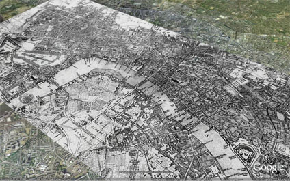
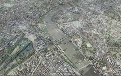
Using image overlays it is possible to compare cities over time. The above and below images illustrate the layout of London in 1690 - post Fire of London - in Google Earth. It is interesting to note when changing the transparency how the shape of the Thames has been modified with the building of Embankment.
You can download the kmz file to fly into the overlay in Google Earth here
Beautiful, Andrew. That's fantastic. I just posted a speculative piece around this idea, completely unaware of your work here, and a colleague pinged to alert me! Great stuff.
ReplyDeleteI manipulated your overlay slightly to what I think is a more accurate position. Check this out: London1609.kmz
ReplyDeleteThis is great!! I did some small, very isolated QT movies of this sort of thing of Paris a few years ago. But all I could do was to continually replay them. How do you make a GE overlay? I have a huge and very detailed six panel 18th engraved map of Paris would like to try to...
ReplyDeleteR Chenoweth
nice post, it's really interesting for me today, thx
ReplyDeleteSorry to comment on such an old post, but just found this and was wondering is that Blackfriars Bridge on the map? What's it doing on a 1690 map if it wouldn't be built for another 60 years (http://tinyurl.com/cyou35f)? Was there a previous incarnation of the bridge?
ReplyDeleteThanks for the great layer!