CityDashBoard TalesofThings MapTube
Qrator Tutorials About Digital Urban
MRes ASAV SurveyMapper Contact Us

2005-11-25

Imaginary Cities - Fantasy Architecture


Virtual London allows developers to add and remove changes to the skyline. All well and good but due to issues, often political, its not possible to place these skyline changes online. As such an outlet is needed whereby proposals could be viewed without any politically sensitive views interfering with the models.


What therefore is needed is a 3D city which does not relate to the actual city - an Imaginary Virtual City? This goes back to some extent to our old research work of '30 Days in ActiveWorlds' where a Virtual Town developed, built by 100+ people using 80,0000 objects over a period of a month. It also dips into the 'Shared Architecture' work, allowing people to send in photos of their favorite building to be modeled.

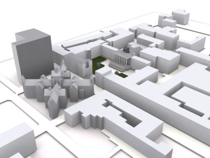
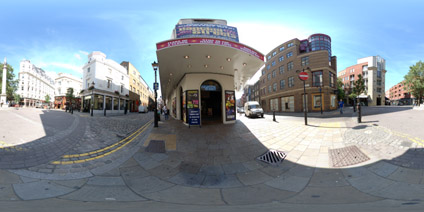
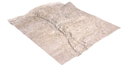
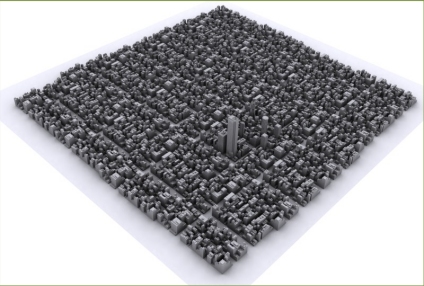
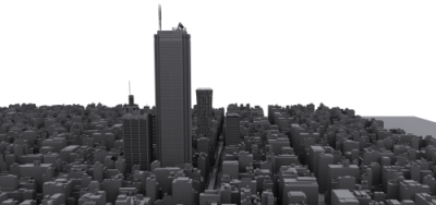
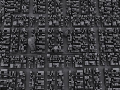
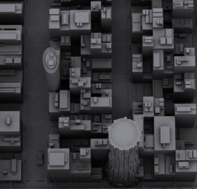
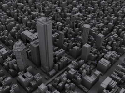
We are proposing a city built in 3DMax of nondescript streets whereby each new building can be added and the city re-rendered - some images of which can be seen below.

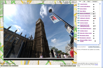
.

Users can send in either 3D models or hand sketches of drawings they would like to see built and we will place them in the city.

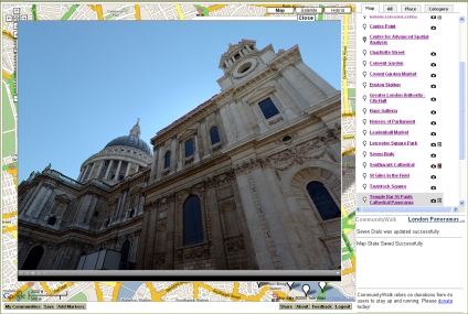
.

Users could also specify on which block of the city they would like to see their building developed - creating a simple real estate structure and a basis on which to map the cities growth.

.

If anyone wants to send in either a 3D model or simply a sketch of a building they would like to see we will add it to the city. Full credit will of course be included.

2005-11-24

Rendering 3D Models


With 3D models even the best ones can look poor with the wrong choice of renderer. With the right render however, even simple block models can look impressive. This one is a simple render of UCL but with the right lighting and settings it can be made to look almost like a man-made architects model.

Rendering times with are however long so movies can take weeks to create. We are working on producing a movie of the Virtual London model with the same render techniques...

2005-11-23

Server Failure - Fixed

University College London has just installed a new firewall without warning so the images on the blog are down for approx 8 hours.

Apologies for this... if your new to the site please pop back later :)

Andy

- As an update we are now back up and running, apologies for the down time -

2005-11-18

Cut Out and Keep Union Square San Francisco Panorama


With the weekend upon us we thought it was time to put up a non-digital panorama. Simply download the pdf file, cut out and fold along the lines to make your own view of Union Square San Francisco.

If anyone does this we would love to have a photo to add to the blog...

Download the PDF and Cut Out. (4.9mb).

Paddington Basin London Panorama


Paddington Basin is regenerating the local area. Providing both residential, office and retail space it is transforming the previously run down inner city site.

The master plan for the area was drawn up by Richard Rogers in 2001 with completion due in the late 2000's.

View the Quicktime panorama of Paddington Basin London. (2.1mb).

Broadgate Arena London Panorama


Broadgate Estates adjoins Liverpool Street Station in London, providing office, retail and leisure space. In the centre is Broadgate Arena which is described on other websites as a 'spectacular amphitheatre and is a focus of activity throughout the year'. Well I wouldn't go as far, but take a look at the panorama and make your own mind up...

View the Quicktime panorama of Broadgate Arena London. (2.3mb).

2005-11-17

Seven Dials London Panorama


Seven Dials dates back to 1692 when plans for the area were submitted to Sir Christopher Wren, the then Surveyor-General for London. The area is based around 7 streets cumulating in a star shape around the Sun Dial - thus the name Seven Dials.

The original Sun Dial was designed by the architect and stonemason Edward Pierce. It remained on the site until 1773 when it was demolished to remove a gathering point for undesirables.

In 1984 funding was raised to rebuild the dial signaling the regeneration of the area.

View the Quicktime panorama of Seven Dials London. (2.3mb).

London Google Map Panoramas - Community Walk Update


Thanks to Community Walk we are now able to view panoramas in Google Maps. Using an 'iframe' function its possible to view both windowed and full screen panoramas directly within the interface.

At the moment this is beta and only the Houses of Parliament view has the functionality. The rest will be added over the coming days.

*Update 17th November 2005*


All the views now include panoramas which can be viewed within Google Maps, click enlarge to view them full screen.

Click here to view the Google Map London Panoramas

2005-11-16

Global Warming - London Flooding

With a 3D model it is possible to visualise the impact of sea level change. South London is built on marsh land and is thus more prone to flooding. We have produced a movie that illustrates sea level rise in metres. It clearly picks up the moat around the Tower of London within a metre increase and then follows on to flood most of the Waterloo/South Bank area of London. The movie below does not take into account flood defenses, merely a direct sea level rise.


If we exaggerate the surface model of London in terms of height it shows clearly the reason why South London floods extensively compared to North of the Thames, as the image above illustrates.

You can view the full Virtual London model via the links in the side menu..

2005-11-15

3D Street Furniture - London Phone Boxes


When visualising the city it is important to include common street furniture as such items are central to the urban experience. As such we have modelled a couple of London Phoneboxes to go into the wider model.

As soon as Google Earth allows texture mapping (or before if anyone wants them?) we will add these throughout London based on location.

2005-11-11

Google Earth London Eye Model


Originally modelled in 3DMax we have slightly revamped the London Eye for Google Earth. There are a few known issues but it illustrates how even complex landmarks can be imported.


You can download the kmz file to fly into the model in Google Earth here (1.4Mb)

Other models including St Pauls and a view of London in Google Earth can be viewed in previous posts.

As ever any comments are welcome..

2005-11-10

3D London Tube - Streaming a Movie via Flash


The majority of our movies have been encoded in Divx which although useful for compression does mean that people need the correct codec installed. As a test we have put online a movie encoded into Flash so the majority of users will be able to view it. The filesize is also compact, down from 23Mb to 2.2Mb which should be streamed from our server.

The movie itself features a fly through of the iconic tube map of London.

Any comments would be welcome...

View the movie encoded in Flash. (2.2mb).

2005-11-09

Navy Pier Chicago Panorama


Construction of the Navy Pier, Chicago, begun in 1914 under the direction of architect Charles Sumner Frost. The pier was originally designed a shipping and recreational facility, it is now however a theme park and shopping mall.

The Pier is also however a great place to view both the cities skyline and Lake Michigan. The Lake at 118 miles wide and 307 miles long is one of the five great lakes of America.

View the Quicktime panorama of the Navy Pier Chicago. (2.3mb).

2005-11-07

BART San Francisco Panorama


The Bay Area Rapid Transist System in San Francisco is known as the BART. Out of a total of 43 BART stations there are 15 surface, 13 elevated and 15 subway stations. Opened to the public in 1972 it provides a quick and easy way to explore San Francisco.

View the Quicktime panorama of the BART Station, Berkeley, San Francisco (1.9mb).

Twin Peaks San Francisco Panorama


The small parking area at the northern tip of Twin Peaks Boulevard has one of the best views of San Francisco and the Bay Area. It allows you to view the city and its landmarks including the Golden Gate Bridge and Alcatraz in the distance.

View the Quicktime panorama of Twin Peaks San Francisco (4.1mb).

Jay Pritzker Pavilion Chicago Panorama


Central to Millennium Park in Chicago is the Frank Gehry-designed Jay Pritzker Pavilion, described as the most sophisticated outdoor concert venue of its kind in the United States. The Pavilion stands 120-feet high overlooking the Great Lawn which accommodates an additional 7,000 people.

View the Quicktime panorama of the Jay Pritzker Pavilion Chicago (3.6mb).