























The Federation Tower is a skyscraper currently under construction as part of the Moscow International Business Center. Construction of the towers began in 2003 and is ongoing - see the Wiki page for full details.
Showing posts with label 3D City Model. Show all posts
Showing posts with label 3D City Model. Show all posts
2010-03-18
Federation Tower Moscow City District Tour
Below is a virtual tour of the City District in Moscow with a focus on the Mirax Federation Tower:
The Federation Tower is a skyscraper currently under construction as part of the Moscow International Business Center. Construction of the towers began in 2003 and is ongoing - see the Wiki page for full details.
The Federation Tower is a skyscraper currently under construction as part of the Moscow International Business Center. Construction of the towers began in 2003 and is ongoing - see the Wiki page for full details.


2010-02-03
The Attractive City Generator
The 'Attractive City Generator' is an an interactive installation by Sofia Georgakopoulou, Edyta Augustynowicz and Setafnie Sixt. It was created as part of the The Master of Advanced Studies in CAAD at ETH in Zurich. The students task was to explore urban design methodologies with the use of parametric programs based on object oriented programing, with their particular area of interest focosed on interactivity in urban planning. The video below is extremely impressive, indeed it raises the bar for student projects:
We featured some other work from the course earlier in the week, detailing a 3D City based on Conway's Game of Life, with this quality of output compared to other courses we have seen ETH is up there with some of the best.
We featured some other work from the course earlier in the week, detailing a 3D City based on Conway's Game of Life, with this quality of output compared to other courses we have seen ETH is up there with some of the best.
2009-12-21
Medieval Dublin 3D Model
The ability to view the city over time is core to data exploration and integration within a GIS. It also allows lots of nice visuals to be created and one excellent example is Medieval Dublin - From Vikings to Tudors - an interactive DVD box set that illustrates life in Dublin between 800 and 1540 AD:
The DVD explores a 3D model of the walled city, visiting a Viking house as well as strolling down a medieval street.
For more details see http://www.medievaldublin.ie/index.php
Also, take a look at the Silverlight Deepzoom version in the hunt for something rather more seasonal...
The DVD explores a 3D model of the walled city, visiting a Viking house as well as strolling down a medieval street.
For more details see http://www.medievaldublin.ie/index.php
Also, take a look at the Silverlight Deepzoom version in the hunt for something rather more seasonal...
2009-08-07
IPhone 3D Texture Mapped City: Paris
In the comments to our recent post on 3D New York on the iPhone Matthieu suggested we ran a search for Paris. The clip is below, all we can say is wow:
Paris 3D is the first full texture mapped 3D city on the iPhone and it is very impressive. With other cities to come take a look at www.mobile3dcity.com for more info.
iTunes link : http://itunes.apple.com/WebObjects/MZStore.woa/wa/viewSoftware?id=323822225&mt=8
Paris 3D is the first full texture mapped 3D city on the iPhone and it is very impressive. With other cities to come take a look at www.mobile3dcity.com for more info.
iTunes link : http://itunes.apple.com/WebObjects/MZStore.woa/wa/viewSoftware?id=323822225&mt=8
2009-07-13
Chicago Architecture Foundation: Chicago Model City
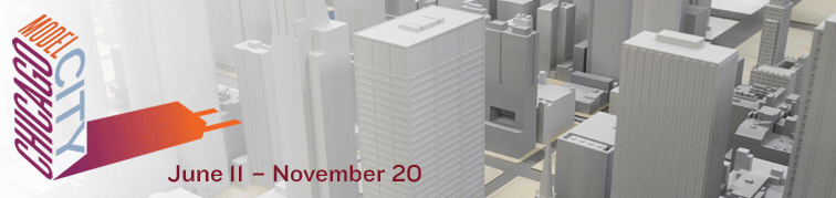
How does a city as vast and complex as Chicago take shape? What are the consequences—intended and unintended—of urban planning? What challenges do planners face?
Beyond its reputation as a global metropolis featuring world-renowned architecture, Chicago enjoys special status: it is a model for understanding all cities. Enormous size, diverse population, booming industry, and complex infrastructure have made Chicago emblematic of modern life. Urban planners, sociologists, and historians have studied Chicago more than any other American city.
In recognition of the Plan of Chicago centennial celebration, the Chicago Architecture Foundation presents a new exhibition, Chicago Model City. The exhibition considers the philosophy of “thinking big” by examining historic and contemporary urban plans of all sizes. Chicago Model City includes photographs, maps, videos, digital visualizations, and a large-scale model of Chicago’s Loop—designed to be a permanent attraction and centerpiece of CAF.
Part of the installation is a new 'model' of Chicago, comprising of over 1000 buildings - the clip from NBC 5 provides a glimpse:
The Chicago Model City exhibit encompasses five thematic sections.
Global City examines how transportation networks form the basis of Chicago’s econo
mic wealth and innovative potential. The exhibition looks at the development and impact of O’Hare Airport and freight railways.
Connected City investigates how Chicagoans’ ability to circulate through their region encourages urban growth, drives real estate development, and contributes to quality of life. Visitors will also see how highways and Chicago's famous "L" played an important part in Chicago's development.
Green City focuses on the impact of urbanization on the health of citizens and the region.The exhibition studies programs such as Mayor Daley’s Chicago Climate Action Plan and Jane Addams’ public heath initiatives.
Beautiful City features Chicagoans’ efforts to build an efficient, pleasurable, and moral environment through beautification. Burnham and Bennett’s 1909 Plan of Chicago is explored.
New City investigates the belief that demolition and rebuilding will solve urban ills. CMC examines the IIT campus and its surrounding neighborhood—which the university and other institutions “renewed” beginning in the 1940s.
Take a look at http://www.architecture.org/ for more info.
2009-06-06
Typographic City
My Design Process from Joe Minham on Vimeo.
We bookmarked this one on Vimeo a couple of weeks ago as its really clever - the city is made up of... well give it a play and your see.
Created by Joe Minham
2009-06-03
World's Most Realistic 3D City Models - C3?
We have covered C3 a number of times here on digital urban, a company that is producing high quality 3D models - a demo is below:
Trondheim 3D demo in HD from Morten Jacobsen on Vimeo.
Ludvig Emgard of C3 Technologies presented a talk at this years Where 2.0 entitled "World's Most Realistic 3D City Models?". The movie below is well worth a look as it talks though the technology behind the modelling process:
The process is automated, with the textures and mesh produced purely from imagery and not from the more traditional LiDAR approach.
See http://kart.sesam.no/3d/ for a 3D flythough (Windows only at the moment) and http://www.c3technologies.com for more info.
Trondheim 3D demo in HD from Morten Jacobsen on Vimeo.
Ludvig Emgard of C3 Technologies presented a talk at this years Where 2.0 entitled "World's Most Realistic 3D City Models?". The movie below is well worth a look as it talks though the technology behind the modelling process:
The process is automated, with the textures and mesh produced purely from imagery and not from the more traditional LiDAR approach.
See http://kart.sesam.no/3d/ for a 3D flythough (Windows only at the moment) and http://www.c3technologies.com for more info.
2009-06-01
Vienna 3D - Visualization by Arkadiusz Szadkowski
Vienna 3D - Visualization of Arkadiusz Szadkowski MSc from Arkadiusz Szadkowski on Vimeo.
Arkadiusz sent as a email over the weekend about the visualisation of Vienna he has produced as part of his Diploma at the Warsaw University of Technology
(Department of Photogrammetry and Remote Sensing) & Vienna University of Technology
(Institute of Photogrammetry and Remote Sensing).
We are impressed and it shows how times have changed - this is a high quality model with accuracy on the XY of 0,3 metre and Z axis of 0,2 metre. Where as once such models would of been team built with high end specialized software of note in the movie is the use of Google SketchUp.
Basic data was provided by the Surveying Department of the City of Vienna, Austria with 300 terrestrial images collected by Arkadiusz himself. The full list of software used is as follows:
# Adobe After Effects CS4 (intro) - we like the clouds...
# DTMaster (filtering, postprocessing LiDAR (ALS) data)
# SCOP++ (DTM & nDSM generatiing)
# GML Undistorter (undistorion of pictures)
# GVE (supporting modelling)
# Ruby Scripts (import point cloud to SketchUp)
# Google SkecthUp 7 (modeling, texturing, animating)
# Gimp (2D graphic processing)
# Windows Movie Maker (final sync & animation)
See http://city3d.blogspot.com/ and http://miasta3d.blox.pl/html for more information. You can also view and download the models via the 3D Warehouse (direct link).
2009-05-12
Portland 3D City Model
The movie above details a digital 3D model of Portland, Oregon created by NC3D using information gathered from Metro, the City of Portland, ODOT, Tri-Met and numerous firms and individuals including Williams and Dame Development, Ankrom Mosian, FFA, GBD, Hennebery Eddy, Thomas Hacker and ZGF Architects.
The Portland City Model was created in 3D Studio Max and is available for license direct from NC3D...
2008-12-08
Urban Circus: The Urban Engine Real-Time Demo
Urban Engine - live demo of 3D real-time in action from Urban Circus on Vimeo.
Embedded above is a real-time look at the Urban Engine presented by Dr Ben Guy, Director of Urban Circus.
The engine seems impressive, especially in terms of transport visualisation, below is an example of using the engine to visualise a proposed transit station in Broadbeach on the Gold Coast of Australia:
Bus Rapid Transport - Broadbeach from Urban Circus on Vimeo.
The ability to fly real-time through a scene is without question one of the most important aspects of city models for urban planning / architectural visualisation when aiming to communicate 'non fixed' design decisions. Highly rendered fly through movies can often alienate the public at large as it seems as if planning decisions have already been taken, leaving the renderings to come across as sometimes little more than marketing movies.
Take a look at http://www.circus3d.com/ for more info.
2008-12-03
3D Trondeim: The Latest Model from C3
Trondheim 3D demo in HD from Morten Jacobsen on Vimeo.
The movie above illustrates a preview of 3D Trondhiem in Norway, produced by C3.
The modelling process is automated, with the textures and mesh produced purely from imagery and not from the more traditional LiDAR approach. C3 are defiantly a company to watch out for in terms of 3D city models.
See http://kart.sesam.no/3d/ for a 3D flythough (Windows only at the moment) and http://www.c3technologies.com for more info.
Subscribe to:
Posts (Atom)