 Peter Murphy
 (one of the leading lights in the panoramic world) sent us a email on Monday with the thought of creating panoramas from a Digital Earth. The concept is simple - grab a series of screen shots while rotating above the earth and then stitch the images as if they were normal photographs.
A day is a long time in Internet based tutorials and this is now an update of the original as a result of Gaby, a digital urban reader, writing a
kmz tool to dramatically simplify the process of capturing screen shots. The whole process should take approximately 40 minutes.
The first step is to go to
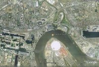
Gabys Kmz Panorama Capture Tool and type in the Lat/Long of the location you want to capture - in our case above the Millennium Dome in London.
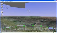
To create panoramas it is important to rotate the camera around the nodal point of the lens in order to minimise any parallax error as the scene is captured. Previous to Gaby's tool the best way was to use the 'Flight Simulator Mode' by clicking '
Ctrl-G'. Combining this with a 'left mouse click and drag' action you can look around the scene and thus simulate a panoramic camera.
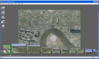
You can now simply load up the
kmz file which is output from your Lat/Long co-ordinates and a series of
placemarks are presented in the Google Earth, each representing camera locations. Select each
placemark and wait for the streaming in Google Earth to reach 100%, now use File - 'Save Image' and call your image image1.
jpg. Go through this for each
placemark and you should end up with 28 images, each saved in sequence -
ie image 1.
jpg to image 29.
jpg.
Once you have your numbered
screengrabs you now need to stitch them, we used
Stitcher from
RealViz, you can download a trial version from the
RealViz website. If you are a
PTGui user we have created a Template to automatically stitch your images.
Download the Template and follow these steps:
1) Open
PTGui and click Select Source Images - Navigate to where you saved your
screengrabs and select all of them.
2) A Camera Lens
Dialoge will appear, simply click 'Cancel'. Your images will then load into
PTGui.
3) Click File 'Apply Template' and select the location of the
GoogleEarthTemplate.
pts saved from above.
Your images will now automatically align, you can now complete the process by selecting the 'Advanced' button in the top right hand side of
PTGui and then 'Create Panorama'. Save your panorama as a
Tif, we normally output at 6000x3000 pixels. Advanced users of
PTGui can add their own Control Points and stitch as normal, lens
parameters should be 30mm Rectilinear.
To stitch the images you can also use the
AutoStitch feature of
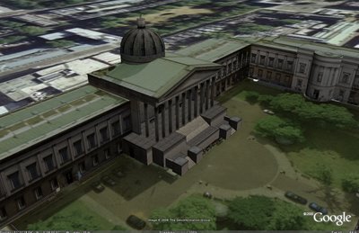
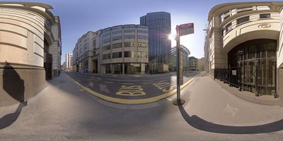
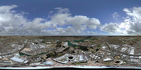
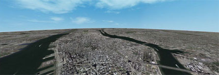
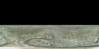
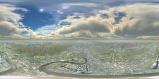
RealViz to simply load in the images and automatically create a panorama. It should be noted that the curve of the earth will not stitch perfectly due to parallax error resulting from the Flight Simulator mode of Google Earth, the image left illustrates this (click for a larger version).
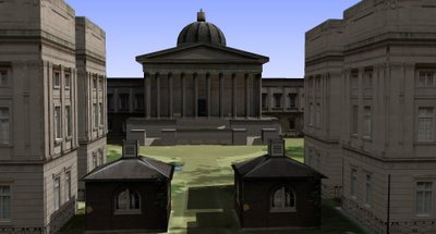
Fixing the parallax's error is simply a case of slightly cropping off the top of the resulting panorama to give us the image as below, this applies to both
PTGui and
Realviz Stitcher outputs:
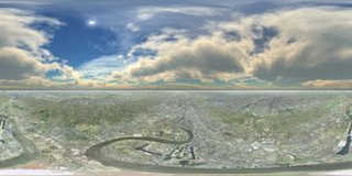
As Google Earth doesn't include clouds we can now add them in as a new layer in
photoshop. We used a panoramic image of clouds from
TurboSquid, these used to be free but are now $5 each. If you don't have a cloud panorama then you can always create your own using
Terragen, there is a
great tutorial on how to do this here.
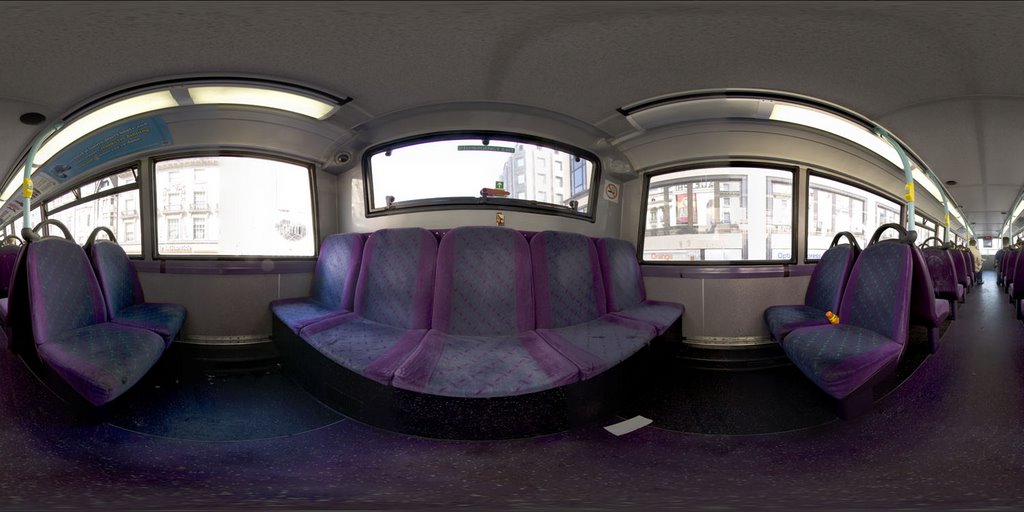
Adding the clouds gives you the final panorama over London (click for a larger view) :
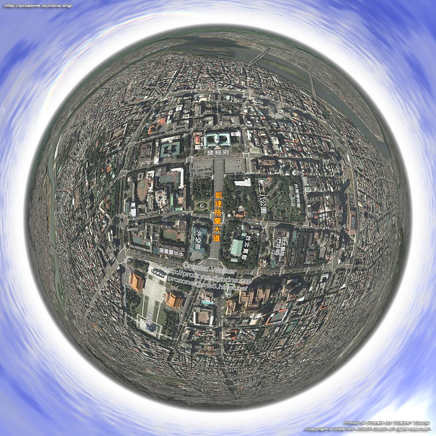
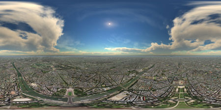
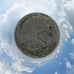
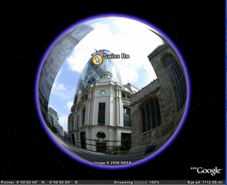
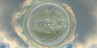
Changing the projection of the resulting image allows a number of views such a hyperbolic image of London from Google Earth:
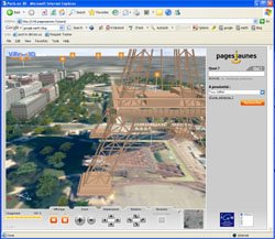
Finally to create a
Quicktime Virtual Reality scene from the image - so you can look around the panorama -
download Pano2QTVR.
The resulting
QTVR can be viewed here (2.8Mb).
Of note in the final scene is how the Google copyright crops up in various places in the image. This is due to each
screengrab containing the Google overlay and depending on the overlaps some are automatically blended out in
RealViz and some remain... *update - using
PTGui all copyright seems to be removed, this opens up the question on the legality of creating panoramas? *
Peter has used
NASA's Worldwind to the same effect,
see here for his panorama of the Southern Highlands (
Quicktime format).
If you create any panoramas using Google Earth we would love to hear from you...
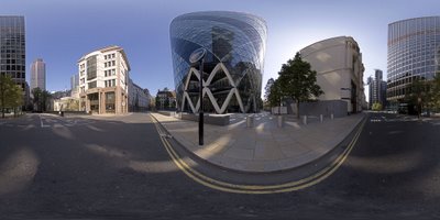
Panoramas submitted so far cover
London,
New York,
Moscow,
Belgium,
Paris and
Sydney.