
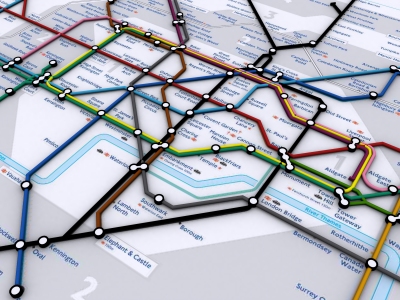
Rapid visualisation of networks can be carried out by simply converting Adobe Acrobat documents to .dwg format as we detail below with a quick render of the London Tube map:
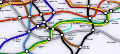
Modelling of the tube lines was possible using the following workflow:
1) Download a Acrobat formatted 2D map from the London Transport site;
2) Import into Adobe Illustrator;
3) Export as .DWG which preserves the vector line data;
4) Import into 3DMax and converting the line data into 3D Splines.
This provides a quick and easy way to transform a 2D map into 3D. A movie illustrating work in progress is embedded below:
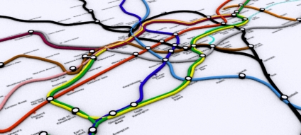
The same technique can be used for the actual geographical location of the London Tube Network:
These are sample images of a file recently retrieved from a lost disk - we will be updating the 3D Map over the coming weeks.
i tried this, but as i am a 3d studio noob, i was instantly baffled and left thinking.. is this really a "tutorial"?
ReplyDeleteThis is pretty great.. thanks. I was talking with some people today about Underground London... and somehow found your site.
ReplyDeleteThis comment has been removed by the author.
ReplyDeleteThis comment has been removed by the author.
ReplyDeleteHi,
ReplyDeletesorry for the other comments
I wanna know how i can make a tub metro(underground) map please. Thanks
hi
ReplyDeletei have a problem during the export and the import in 3dsmax can you explain (with capture if it s possible) how you do?
excuse my english i m french
You should be able to import dwg.. this brings in the lines - have you been able to import a dwg file at all?
ReplyDeleteAndy