
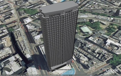
We have placed online a first draft version of Centre Point in London. Centre Point stands at 117m on the junction of Oxford Street and Charing Cross Road. The building, completed in 1967, is made out of pre-cast concrete and at the time held the honour of the worlds tallest concrete tower.
The building is a controversial landmark in London with its unique architecture. Despite its appearance it is now a Grade II listed building.
You can download the kmz file to fly into the model in Google Earth here (170k)
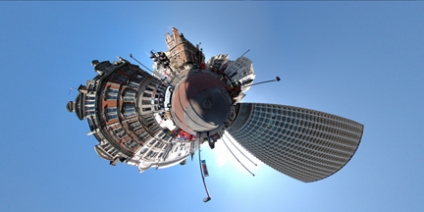
You can also view a panorama of the building in full screen via the QuickTime plugin, allowing you to view the scene in 360x180 degrees at high resolution.
View the panorama of Centre Point, London (2.8mb).
Hi,
ReplyDeleteWell done!! That is some excellent work you have done there. I now have the first 3D London building for Google Earth. Makes a nice change from only having US cities in 3D.
I must say the Centre Point you created is an exact in every detail. I have saved it to my folder list in Google Earth. Keep up the very good work! I am now looking for a 3D BT Tower, Cannery Wolf complex and Tower 42 to add. I would like ot have a go myself.
Regards,
Charlie
Hey! What a great site!
ReplyDeleteI'm doing a project on the Centre Point for my MSc and I am amazed with what I just got here!
You're already one of my top bookmarks!
;-)