2011-12-19
New Paper: An Internet of Old Things as an Augmented Memory System
Abstract
The interdisciplinary Tales of Things and electronic Memory (TOTeM) project investigates new contexts for augmenting things with stories in the emerging culture of the Internet of Things (IoT). Tales of Things is a tagging system which, based on two-dimensional barcodes (also called Quick Response or QR codes) and Radio Frequency Identification (RFID) technology, enables the capturing and sharing of object stories and the physical linking to objects via read and writable tags.
Within the context of our study, it has functioned as a technology probe which we employed with the aim to stimulate discussion and identify desire lines that point to novel design opportunities for the engagement with personal and social memories linked to everyday objects. In this paper, we discuss results from fieldwork with different community groups in the course of which seemingly any object could form the basis of a meaningful story and act as entry point into rich inherent ‘networks of meaning’. Such networks of meaning are often solely accessible for the owner of an object and are at risk of getting lost as time goes by.
We discuss the different discourses that are inherent in these object stories and provide avenues for making these memories and meaning networks accessible and shareable. This paper critically reflects on Tales of Things as an example of an augmented memory system and discusses possible wider implications for the design of related systems.
http://www.springerlink.com/content/v8405w81p2j35451/
2007-09-26
Digital Urban - The Visual City Working Paper
We have a new working paper out entitled 'Digital Urban - The Visual City', hopefully worth a read...Nothing in the city is experienced by itself for a city’s perspicacity is the sum of its surroundings. To paraphrase Lynch (1960), at every instant, there is more than we can see and hear. This is the reality of the physical city, and thus in order to replicate the visual experience of the city within digital space, the space itself must convey to the user a sense of place.
This is what we term the “Visual City”, a visually recognisable city built out of the digital equivalent of bricks and mortar, polygons, textures, and most importantly data.
Recently there has been a revolution in the production and distribution of digital artefacts which represent the visual city. Digital city software that was once in the domain of high powered personal computers, research labs and professional software are now in the domain of the public-at-large through both the web and low-end home computing.
These developments have gone hand in hand with the re-emergence of geography and geographic location as a way of tagging information to non-proprietary web-based software such as Google Maps, Google Earth, Microsoft’s Virtual Earth, ESRI’s ArcExplorer, and NASA’s World Wind, amongst others.
The move towards ‘digital earths’ for the distribution of geographic information has, without doubt, opened up a widespread demand for the visualization of our environment where the emphasis is now on the third dimension.
While the third dimension is central to the development of the digital or visual city, this is not the only way the city can be visualized for a number of emerging tools and ‘mashups’ are enabling visual data to be tagged geographically using a cornucopia of multimedia systems.
We explore these social, textual, geographical, and visual technologies throughout this latest working paper.
Download the full working paper (4.9Mb, .pdf)
2007-09-18
Working Paper - Public Domain GIS, Mapping & Imaging Using Web-based Services
The paper outlines Google Map Creator, Image Cutter, Google Earth Creator, Map Tube and our recent work in Second Life.
In the last five years, public domain GIS (geographic information systems) software for map display and beyond has become available for non-expert users in the public domain, the best examples being the various products from Google such as Google Maps and Google Earth.
We have devised various software to enable non-experts to take appropriate map data in standard formats and to transform them so that they can be displayed by these software in a one stop action.
The first system is called GMapCreator and we show how the software can be used to produce any number of map layers which can be overlaid on Google Maps, can be combined and toggled in combination, and whose transparency can be varied for a myriad of presentation purposes.
We then evolve this into a form called ImageCutter which takes any large image and puts this into a Google Map so that the zoom and pan features of the software can be exploited. These software are now available through a site we call MapTube which is a server pointing to various maps created by GMapCreator which is a rudimentary archive of virtual map resources.
Finally, we sketch how these software are being moved into 3D using the capabilities of Google Earth and Second Life to display geographic imagery.
You can download the working paper in .pdf format (3301KB)
2007-04-04
Societies and Cities in the Age of Instant Access
We are on the verge of what many are calling the "second information revolution," based on ubiquitous access to both computing and information. Handheld communication devices will become portable and even wearable remote control devices for both the social and physical worlds. At the same time, access to information will likely flourish, with an explosion in the volumes of data collected and distributed by these new devices—volumes of information about people delivered to more and more people, in new ways. The technologies of instant access have potential to transform dramatically our lives, cities, societies and economies much like the railroad, telephone, automobile and Internet changed our world in the previous ages. This book contains chapters by leading international experts who discuss issues surrounding the impact of instant access on cities, daily lives, transportation, privacy, social and economic networks, community and education.
Featuring a chapter by Mike Batty and myself entitled 'Imagining the recursive city: Explorations into urban simulacra', Societies and Cities in the Age of Instant Access is a timely book looking at the impact of rapid global communication and information systems on our urban realm.
The book is however $169 dollars which is a high price, mainly it seems that Springer is looking at the library and academic market. We are not sure how this can be justified and it indicates an increasing trend in academia for high book prices. It is in some ways annoying that you write a good book chapter for a strong book only to find it overpriced.
2006-10-25
Digital Urban Journal (?)
As technology moves at an ever increasing pace traditional paper based academic journals are failing to keep up. With over a 12 month waiting time to be published in the best journals, such as Environment and Planning B which is based here in CASA, by the time the paper comes out it is often out of date.A prime example of this is the latest 3D Modelling/Google Earth research. With API's changing on an almost monthly basis and new tools emerging all the time any paper reviewing the state of the art needs to published quickly and publications such as EPB or Computers and Environmental Systems simply cannot address this need.
Therefore we are thinking to resurrect the previous Online Journal at CASA - known as the 'Online Planning Journal'. It ran for 3 years from 1999 to 2001 during which a number of notable papers were peer reviewed and submitted. Papers in the field at that time were however few and far between, the research world has since changed and papers in the realm of Digital Urban are increasingly sort after. We will announce further plans as they develop, in the meantime if you are looking to publish a paper in a peer reviewed journal let us know via the email link on the side bar.
Over the coming weeks we will be revisiting some of the classic papers in the field, one notable example is Computable Cities by Professor Mike Batty of CASA. Published in the Online Planning Journal in 1999 it is the paper that led us to CASA and the current field of research. You can read the paper via the previous journal here, you can also check out the full list of articles.
If you would like to be involved in the Digital Urban Journal or would like further details then drop us a line.
2006-07-31
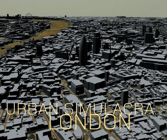
Urban Simulacra London Paper
Recently we published the article 'Urban Simulacra London' in Architectual Design - Sensing the 21st-Century City: Close up and Remote.As the digital revolution deepens and pervades every aspect of daily life, virtual realities begin to penetrate one another in a multiplicity of ways. The amount of sensing data being compiled on the city grows, enabling the construction of virtual realities that can, in turn, be transformed for diverse purposes.
Here, Michael Batty and Andrew Hudson-Smith from the Centre for Advanced Spatial Analysis, University College London, outline how they went about the construction of a virtual city in central London.
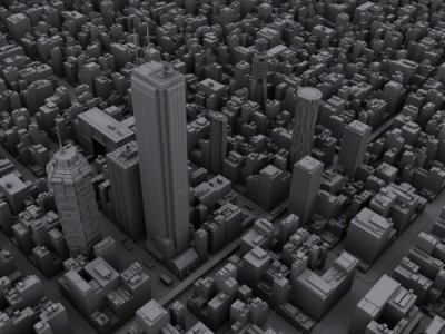
A conventional 3-D-GIS/CAD model was used as the basis on which to build a digital realm in which designers are cast as avatars and populations as agents, so as to define new ways in which to understand and plan the city.You can read the article here (7Mb PDF). The original journal can be purchased from Wiley.
Full Reference: Batty, M., and Smith, A. (2005) Urban Simulacra: From Real to Virtual Cities and Back and Beyond, Architectural Design, Sensing the 21st Century City: The Net City Close-up and Remote, David Grahame Shane and Brian McGrath (Editors).
2006-07-30
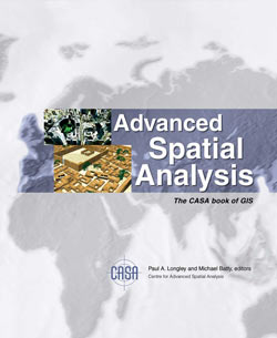
The CASA Book of GIS
We forgot to mention it on this blog before now but for those interested there is The CASA book of GIS which describes cutting-edge developments in GIS applications at University College London's Centre for Advanced Spatial Analysis (CASA). Drawn from archaeology, architecture, cartography, computer science, environmental science, geography, planning, remote sensing, geomatic engineering and transport studies, these applications are emerging as the basis for spatial decision support systems across a wide range of industries and jurisdictions.Accessible and innovative, these projects show how spatial analysis is essential to solving problems and creating insight into how people live and how their quality of life can be enhanced.
It includes a couple of chapters featuring earlier work from this blog and provides an interesting insight into the development and applications of GIS and visualisation in general. A link to the book via Amazon can be found in the side bar.
2006-07-20
Digital Urban - The PhD Thesis
The complete thesis behind Digital Urban is now available online, providing an insight and working examples of the research and background behind the posts on the Digital Urban Blog..Planning is about communication, the communication of space and place in relation to built form. The advent of digital networks provides the opportunity to radically change the concept of communication within not only the urban planning system but also wider fields related to the development of the built environment.
How we communicate is increasingly becoming digital and the rise of the Internet in particular during the last decade has freed planning from the constraints of working hours and the reliance of specific locations and times to portray information.
Information can now be visualised, communicated and manipulated at any location, any place, at any time, as long as we have the political, cultural, and economic means that gives us access to the relevant technologies. These technologies are on the edge of a new revolution in our ability to design, communicate and plan at a distance.
The revolution on the horizon is one of inhabited virtual place; a place where the environment is represented digitally in three dimensions and communication is achieved through avatars, defined as an individual’s visual embodiment in the virtual environment. Avatars in these emerging environments are the stakeholders, the occupants and the commuters of the digital realm. As such they are also the citizens that will design, occupy and manipulate built form in the development of digital planning and they will have a say in the future planning process. These developments contribute towards a digital, ‘Online’ planning system, which is explored in a series of working examples throughout the thesis.
You can read the Thesis here (15Mb PDF).
2006-02-20
Google Earth/Digi Urban in Nature

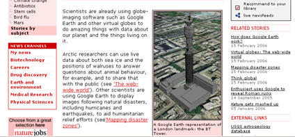
Declan Butler has written a couple of good write ups of Google Earth and Digital Globes in Nature this month. The online news version kindly mentions this blog although sadly gets the URL wrong - its a good article though - the printed version of Nature goes into more depth and is well worth a read.
You can read the article here