
As such Steven Gray here at CASA has produced a proof of concept showing the last hours snow fall in the UK as Tweets and the last 24 in postcode districts (the important part here is the data underneath, not the Tweets as such):
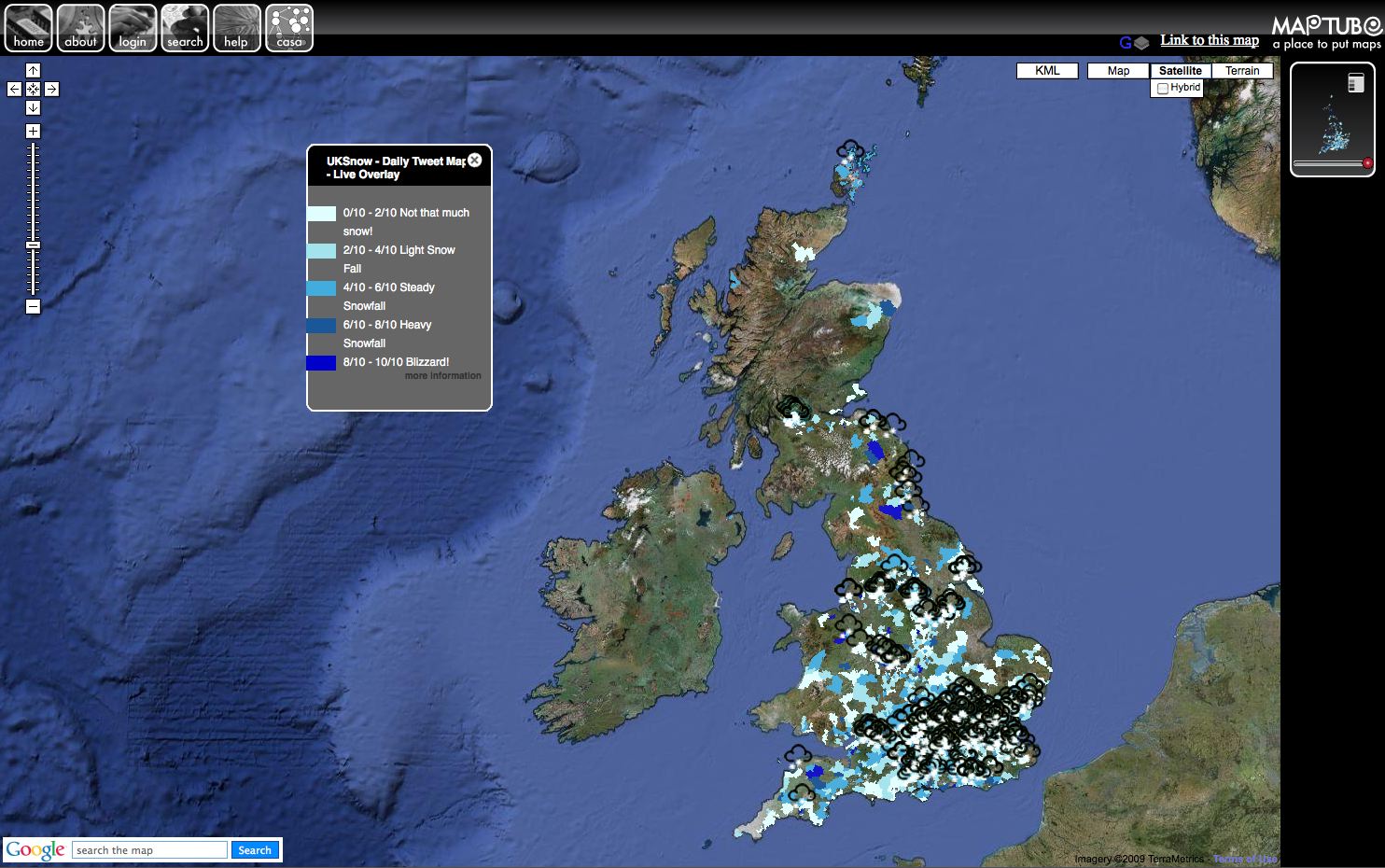
The map is a 'hybrid' of the excellent work by Ben Marsh with his #uksnow Map 2.0, it takes the postcodes and maps the regions with tweets, providing an interesting route to harvest data from Twitter.
You can see the map running live from MapTube - the map dynamically refreshes with fresh tweets every 3 minutes with the areas updated every hour, the map automatically resets itself at midnight.
At the moment the kml is refusing to be clickable via MapTube so if you want a Twitter Map without the postcode areas take a look at Stevens UK Snow Dynamic Crowd Sourced Maps - again it updates every three minutes with Tweets about snow in the last hour - its very neat.
"We are launching such a service in a few weeks"
ReplyDeleteDid you launch? A friend and I recently made http://tweetmaps.co.uk Now we're finding lots of similar services out there! :)