
 We have just received our copies of Virtual Geographic Environments, the book has contributions by Jack Dangermond, Mike Goodchild, Mike Batty, Hui Lin and many others (including ourselves) and provides a unique guide to the current state of play in GIS and virtual environs.
The book is of note as its about to be taken on by ESRI so this current print will be a limited edition and we have two copies to give away.
All you have to do is email us the answer to this simple question:
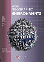
What plugin was used in 3D Max to create the book cover?
Answers need to be received by 5pm GMT Friday 31st July.
Hint - you can find the answer here on digital urban.
Virtual geographic environments are essential to using GIS in design. For example, before a design for a city or landscape can be produced, an environment must be created through GIS. This is then fashioned into a form where users have access to it, first to enhance their understanding through exploration, and then to enable them to change various components in the effort to solve problems that can realize better designs. Only now, through the development of virtual city models and through new ways of enabling users to interact with geographic information using new screen technologies, is the point being approached where design is possible.
Virtual Geographic Environments, edited by Hui Lin and Michael Batty, collects key papers that define the current momentum in GIS and "virtual geographies." In some sense, such environments are the natural consequence of linking GIS to other technologies that deal with information, design, and service provision, and this will undoubtedly grow as it becomes ever easier to integrate diverse software and data across the Web.
The idea that geographic information can be both collected and made available through Web-based services, using Web 2.0 technologies that network many millions of people together, has formed a major research thrust in software development over the last decade.
The numerous contributions by leading members of the geospatial community to Virtual Geographic Environments illustrate the cutting edge of GIScience, as well as new applications of GIS with the processing and delivery of geographic information through the Web and handheld devices, forming two major directions to these developments. But the notion that these Web-based systems can be used to collect information of a voluntary kind through methods of crowd sourcing is also an exciting and widely unanticipated development that is driving the field. As these services gain ground, new business models are being invented that merge proprietary and nonproprietary systems and novel ways of integrating diverse software through many different processes of software development from map hacks to open system architectures.
Virtual Geographic Environments is published by Science Press, China (www.sciencep.com), 350 pages, hardcover. For more information, contact the responsible editors Peng Shengchao and Guan Yan, Science Press (e-mail: guanyan@mail.sciencep.com).
The e-mail doesn't work - and I know the answer as well!
ReplyDeleteoops - email now working :)
ReplyDeleteI just hope I can win... ^^
ReplyDeleteAnd the answer should be a piece of cake to any avid reader of Digital Urban...