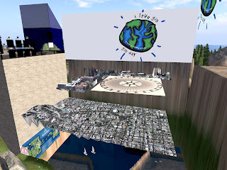
Embedded below is an intriguing demo of GIS in Second Life, termed 'SIMGIS' the technology demo has been prepared for International GIS Day 2008:
Three levels of detail are represented in the movie:
Level 1 is a 1:42-scale bare earth terrain model with an orthoimage "satellite" photo draped over it, just like Google Earth.
Level 2 is a reflective LiDAR (airborne laser scanner) surface 1:16-scale build with the same orthoimage. Since the surface is much more complex and represents all large buildings and trees, the orthophoto looks a bit surrealistic. For Level 2 this is a bug, not a feature.
Level 3 is a classic Second Life type immersive 3D build, but at 1:3-scale with real world textures.
See http://blog.simgis.com/ for more details, thanks go to Mal's SL-Edu Blog

No comments:
Post a Comment