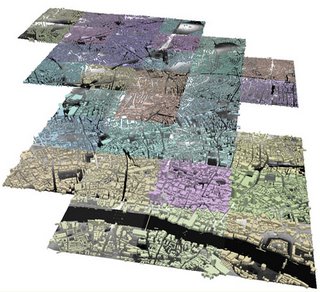
 The Virtual London model at CASA is currently being rebuilt from the bottom up with a new dataset. The new model will include all of the London buildings within the M25 and will be available to London Boroughs within the next few weeks under a cost free license negotiated through London Connects. The image to the right illustrates the first early stages with City, Camden and Islington in place. It is now going out to a few select test Boroughs to make sure it runs 'in house'. Linking this with SketchUp and Google Earth (behind the Boroughs internal firewalls until License issues are overcome) will present planners and architects with a unique tool in which to visualise and plan London. It is also being imported into ArcExplorer to examine the possibilities of Spatial Analysis.
Further updates and screenshots will follow over the coming weeks....

No comments:
Post a Comment