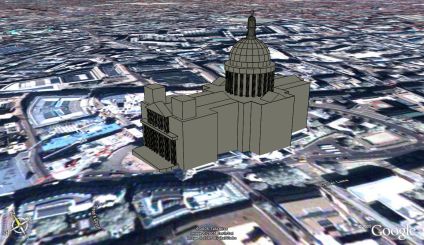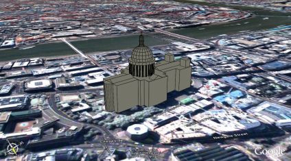
As part of our wider Virtual London work in ESRI's ArcScene and 3DStudio Max we have a detailed model of St Paul's Cathedral, London. However for visualisation in Google Earth low polygon count models are required, requiring the basic rebuild of the main London Landmarks.
Pictured above and below is an optimised St Paul's - a simple enough task but problems have arisen with the Google Digital Elevation model (DEM). St Pauls is located on a natural hill in London but the resolution of the DEM is not enough to compensate for the building size and structure.
By default Google Earth drapes the models to the landscape, resulting in a model which slopes, losing the straight lines and introducing distortion. To get around this it can be placed absolute to the ground, resulting in a 11 metre difference between the front and the rear of the building - as it sits on a hill. This has been compensated for in the model but it throws out the actual building height relative to the skyline.
We have placed the model in Google Earth and a link is provided below to fly around the scene, although the issues of heights needs to be resolved at this present moment.

You can download the kmz file to fly into the model in Google Earth here (84k)

Really nice!
ReplyDeleteThere is but a small problem:
With the newer Versions of GE, the winding order of the polygons is used to determine whether the polygon faces "up" or "down". You will have to correct some of the polygons on the roof. And, with the new shading algorithm of GE the model looks better (in my opinion) if the lines are turned off.
xav
This is great. Is there any way I could get this model to manipulate in 3DStudio Max?
ReplyDeletenice post, it's really interesting for me today, thx
ReplyDelete