
 Google Earth is about data, to construct 3D models of cities you need data on heights and textures. In our post on Canary Wharf we point to how the model was constructed using Emporis as a reference. Another route however is to look at paper models and Skyscrapermodels.us by John Townsend is an excellent resource. The site provides full plans of a number of notable skyscrapers which are designed to be printed out onto card or paper and folded to construct the geometry.
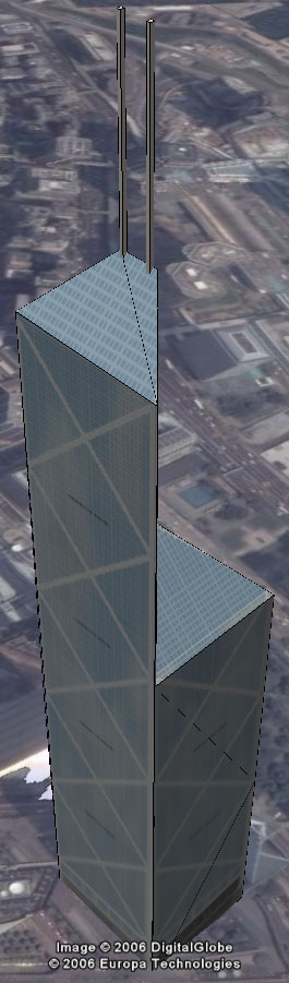
Pictured above are the plans designed by John for the Bank of China in Hong Kong. Our cutting and glueing skills are quite frankly limited but by placing the texture in SketchUp you can cut and fold digitally. Combine this with the ability of Google Earth Beta 4 to import textures and you can quickly create a 3D model which can be exported and viewed in context.
Our model of the Bank of China was made by simply tracing the outline in Google SketchUp for each section and rotating (folding) along the lines as indicated in the drawing. We would be interested in any other models made this way as there are a numerous paper model folding sites on the web.
You can download the model of the Bank of China here (168K)
Other posts of interest are:
Tutorial on creating 360 x180 degree panoramas in Google Earth
No comments:
Post a Comment