CityDashBoard TalesofThings MapTube
Qrator Tutorials About Digital Urban
MRes ASAV SurveyMapper Contact Us
Showing posts with label Google Earth 10-20. Show all posts

2006-01-31

Fitzroy Square - Sample Google Earth London


Fitzroy Square is one London's hidden treasures, designed by Robert Adam it is dedicated to Charles Fitzroy the fourth Duke of Grafton. It was also famously home to Virginia Woolf and George Bernard Shaw.


The model is 1mb in size, which is notable for Google Earth but represents part of the first stage of highly detailed rapid modelling being researched at CASA.


More models will follow in the coming weeks as the development process is refined.

You can download the kmz file to fly into the model in Google Earth here (1m)

2006-01-26

Sneak Peak Google Earth London


We have posted a number of models recently so we thought we would post an image of the level of detail we are working on in Google Earth London. This is a first phase test for new modeling techniques developed at CASA.

Sample high detail Google Earth files will follow shortly....

2006-01-25

London Google Earth 1690


Using image overlays it is possible to compare cities over time. The above and below images illustrate the layout of London in 1690 - post Fire of London - in Google Earth. It is interesting to note when changing the transparency how the shape of the Thames has been modified with the building of Embankment.


You can download the kmz file to fly into the overlay in Google Earth here

2006-01-23

St Helens Google Earth London


As an update to our Natwest/30St Mary Axe model, we have now added in St Helens which is a notable highrise in the City of London. Built in 1969 it stands 118 metres tall and was designed by RWHL Architects.

You can download the kmz file to fly into the model in Google Earth here (35k)

Google Earth Tate Modern


The Bankside Power Station, which is now how to the Tate Modern was designed by Sir Giles Gilbert Scott. Sir Giles is also notable for the design of Battersea Power Station, the Liverpool Anglican cathedral and the British red telephone box.

You can download the kmz file to fly into the model in Google Earth here (20k)

2006-01-20

Google Earth Tower 42 and Swiss Re London


The latest building is Tower 42 in London, coupled with a simplified 30 St Mary Axe. Tower 42 is the tallest building in the City of London at 183 metres compared to 179.8 metres for its neighboring 30 St Mary Axe. Built in 1980 by Architects Seifert and Partners, Tower 42 was originally home to the Natwest Bank with rumours that its unique shape mirrored the Natwest's logo at the time. This seems to be however an urban myth, the building is now an office complex with a restaurant on the 42nd floor offering views of London.

The file is only 28k...


You can download the kmz file to fly into the model in Google Earth here (28k)

2006-01-17

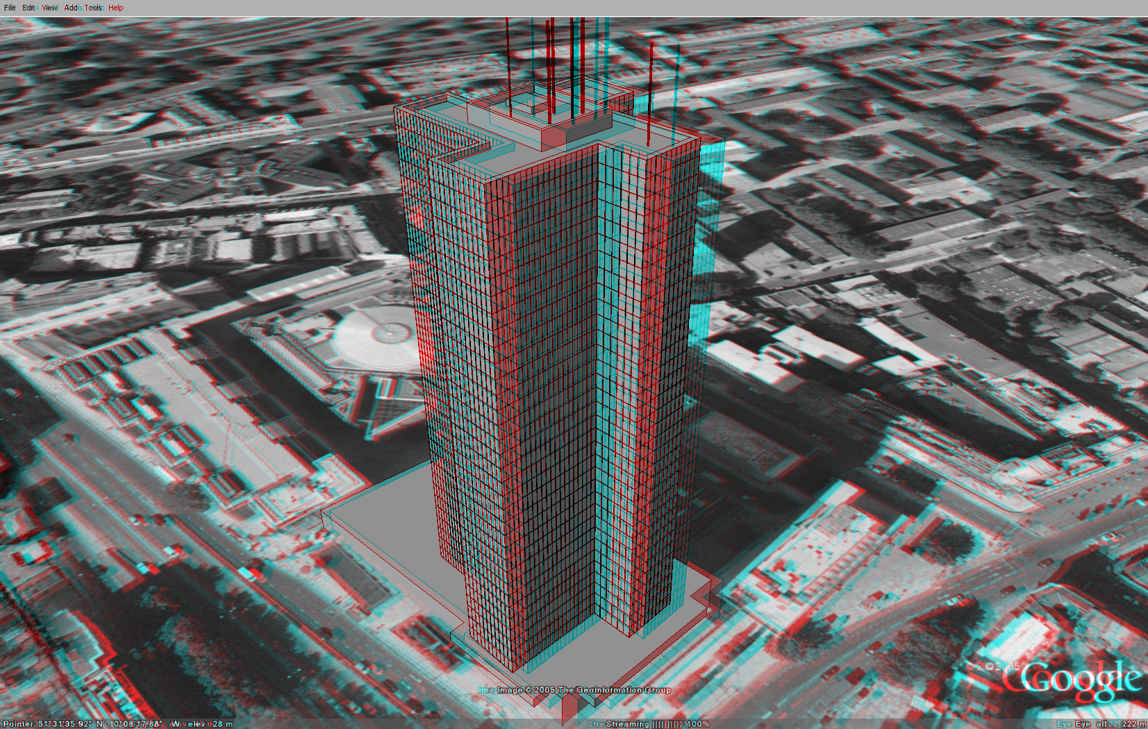
Stereo Anaglyph Google Earth


By grabbing two snap shots in Google Earth you can create anaglyph stereo views. I'm not sure why you would want to.. but if you have a pair of Red/Blue Stereo Glasses its worth a look to see the Euston Tower come out of the screen...

You can view a full screen version of the image here.

Google Earth Euston Tower London


The Euston Tower dominates the top end of Tottenham Court Road, London. Built in 1970 the tower is non-descript, being most famous in London for being the previous home of Capital Radio and dubbed the 'Power Tower'.

You can download the kmz file to fly into the model in Google Earth here (700k)

New BT Tower London Google Earth...


Due to a slight error the BT Tower from our original post was 40m to short! This only came to light when placing in Centre Point and realizing it was taller than the BT Tower.

The model has now been fixed and all heights are correct...

You can download the kmz file to fly into the model in Google Earth here (170k)

2006-01-16

Google Earth Centre Point London


We have placed online a first draft version of Centre Point in London. Centre Point stands at 117m on the junction of Oxford Street and Charing Cross Road. The building, completed in 1967, is made out of pre-cast concrete and at the time held the honour of the worlds tallest concrete tower.

The building is a controversial landmark in London with its unique architecture. Despite its appearance it is now a Grade II listed building.

You can download the kmz file to fly into the model in Google Earth here (170k)


You can also view a panorama of the building in full screen via the QuickTime plugin, allowing you to view the scene in 360x180 degrees at high resolution.

View the panorama of Centre Point, London (2.8mb).